|
Quick Tips |
 |
|
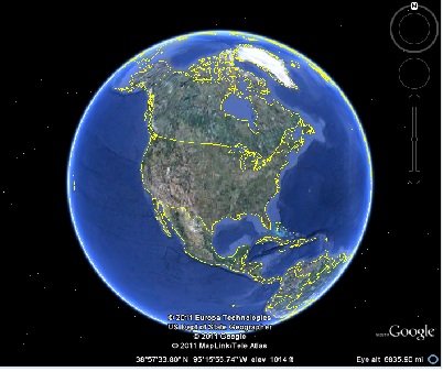
Google Earth Logo, 2011 |
Did you know you can use
Google Earth's map service option to connect to an existing online web
server? Adding GIS data into Google Earth is fast and easy using
web links, KMLs and KMZ files. |
|
|
|
(Name our Newsletter!!)
The Florida Region of ASPRS Newsletter |
|
Dear Florida Region Member,
The
Florida Regions of ASPRS is proud to announce the release of its
quarterly digital publication meant to highlight current
activities, events, and industry news. We are excited to
offer our members the opportunity to contribute to this publication
and highlight their achievements, while at the same
time allowing members to stay informed on issues important to
them.
Some
of you may have noticed that our newsletter is unnamed. What
a better way to get our members excited about our newsletter than to
have a naming submission event. Please feel free to email any
ideas directly to me at: FitosE@halcrow.com.
Sincerely,
Ekaterina Fitos
Newsletter Director and Editor | |
|
President's Corner
Welcome to the renewed Florida Region
Newsletter! After a hiatus the Region is resurrecting our
newsletter in this new electronic format. Special thanks to
Ekaterina Fitos and Brian Murphy for their innovation in bringing forth
this new medium for communication. Also, thank you to our content
contributors both current and future.
The Region's newsletter accomplishes two goals:
First it is a requirement from Nationals for our Annual Report.
Second,
and more importantly, it enables the Region's Board to keep in
communication with our membership to make sure we're all informed on
topics of interest within the Region.
Hopefully
everyone in the Region will find this renewed newsletter to be
informative and convenient. The newsletter is just one of a few
efforts to perform outreach to Region members. Many of our members
have enjoyed the webinars we hosted over the past year and more are
coming in the near future. We've seen an increase in the
participation for the Region's awards program - please keep those
nominations coming... Also, please visit our web site at http://www.flasprs.com/
to keep current on all the upcoming events within the Region.
Thank
you for your membership and participation within the Florida Region of
ASPRS. Please let us know how we can continuously improve our
communication and outreach for the benefit of all Region members.
Best Regards,
Evan Brown, CP, CMS, GISP
President, Florida Region of ASPRS
|
|
Professional Award
By Ekaterina Fitos, MBA, MA, GISP
Florida Region Newsletter Director and Professional Award Chair
This
year we were pleased to see so many of our members eagerly
recognize their fellow peers for the Professional Recognition
Award. Although the decision was difficult, the Florida Region of
ASPRS congratulates this year's winners of the 2011
Professional Recognition Award.
Dr. H. Henry Hochmair - was
nominated for: "his role as a passionate GIS instructor, GIS
researcher, and promoter of GIS science and GIS technology to students
and the general public. He has taught GIS for over 10 years at various
academic institutions in the US and Europe, and developed innovative GIS
classes including a GIS programming class that prepare students for
future challenges in a fast changing GIS world. He
is currently assistant professor and administers the Geomatics program
at University of Florida's Fort Lauderdale campus. . . He has
given over 20 GIS-related national and international presentations over
the past few years and many more to students at local colleges and
science fairs. His GIS research is internationally recognized covering
topics such as transportation analysis and quality assessment of freely
available geodata. He has authored or co-authored over 20 refereed full
papers. . . . His projects bring public awareness to the GIS
field. "
Mr. Ammarin Daranpob- was nominated for being:
"a scientist committed to exploring innovative uses of remote sensing
across multiple disciplines including coastal hydrodynamics and ecology.
One of his strongest traits is that he is willing to conduct field
research in order to acquire ground truth data that supplement his
remote sensing methodologies. He has inspired ...[students], to ensure
that my field work is conducted in a manner that is precise, accurate
and above all relevant to the scope, resolution and capabilities of the
remote sensing data I use. In addition, his approachable demeanor and
unfailing politesse has made him an invaluable resource to the young
graduate students . . .Whether in the classroom, field or laboratory,
Mr. Daranpob exemplifies what it means to be a productive member of the
remote sensing research community."
The
award is meant to recognize up to two individuals in the Florida
Region and Puerto Rico who have made significant contributions or
advancements to the fields of remote sensing, photogrammetric, or
Geographic Information Systems (GIS) profession. Winners of this
year's award will receive a one year paid membership to ASPRS.
Nominations will begin again in June 2012. Award Flyer |
The Region Welcomes Two New Board Members!
The 2011 Florida
Region Board of Directors election results are in, and we are proud to
welcome Michael Joos and Brenda Burroughs as Directors to the Board.
Michael Joos is
a Certified Photogrammetrist and GISP with more than 25 years
experience in the photogrammetric and geospatial profession. Throughout
his career, he has held a
variety of technical and business development positions, and is
currently employed as Manager of US Sale s by GeoCue Corporation.
 |
|
Michael Joos,
Florida Region Director |
Having called
Florida home since 2004, Michael is a native of Pittsburgh,
Pennsylvania, and states, quite unequivocally, that he will forever be a
diehard Pittsburgh Steelers fan. When not rooting for the
Steelers, you just might find him out cruising Florida's back roads on
his 2003 Harley Davidson Road King.
Brenda Burroughs has been in the Geospatial
 |
|
Brenda Burroughs,
Florida Region Director |
Profession for over twenty years. She is currently the U.S Region Sales
Manager for Optech, responsible for sales and marketing of Airborne
Digital Aerial Camera and LiDAR Systems. She began her career selling
Landsat satellite imagery and over the years has expanded her knowledge
and experience to include aerial imagery, digital mapping and analytical
services, with extensive knowledge and background in GIS/Remote Sensing
Applications products and services.
The Region thanks previous Directors, David Alvarez and Keith Patterson, for their service.
|
|
National Summary
By Jeffrey Young
 |
|
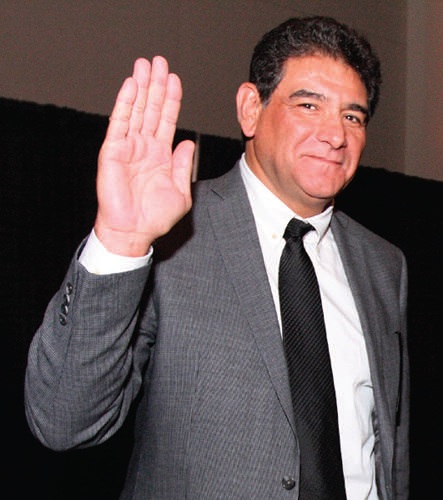
Gary Florence Picture Courtesy of: PE&RS, Vol. 77, No. 7, July 2011 |
Florida Region National Director
New ASPRS President Gary Florence
- Our own Region member Gary Florence was formally sworn in as the new ASPRS President.
Well done Gary!
The University of Florida Wins the GeoLeague Challenge

- The
UF Team won the Geoleague Challenge! There were 4 other teams that they
competed against. These students were extremely energized about
the competition, and were actively engaged in student volunteer duties
at the conference as well.
 |
| GeoGator 2011 GeoLeague Video |
Dr. Paul Wolf Honored as the Educator of Educators
A
great memorial address was given for Dr. Paul Wolf, which honored him
as having been the Educator of Educators. Many of his family, including
sisters, wife, children, and grandchildren, were in attendance. Dr. Wolf
taught (and later co-authored the Elements of Photogrammetry book with)
Dr. Bon Dewitt, another FL Region member.
ASPRS Film Committee
The ASPRS films
committee continues to conduct interviews and to enlarge the
collection has turned to younger ASPRS members, possibly to support
another version of a recruitment video. Also interviews have
been carried out with geospatial scientists who have been
active in applying geospatial data in emergency response efforts (such
as Hurricane Katrina, Haiti, Japan, and the Deepwater Horizon oil
spill). They have also been developing a plan to develop a virtual Wall
of Honor, designed to recognize the achievements of ASPRS members,
connect individuals with resources in the online archive, and to raise
contributions for the ASPRS Foundation.
University of Texas New Student Chapter
A new student chapter was formed at the University of Texas/Dallas. This brings the total for student chapters to 34.
New LiDAR Division
The
Board voted on and approved a new Lidar Division that will discuss,
promote and report on Lidar issues. We, as a society, need to make an
attempt to be the "go to" organization for all things considered
kinematic Lidar.
The next National ASPRS meeting is the fall Pecora 18 conference November 14-17 in Herndon, VA. Hope to see you there!
|
|
Member Projects Highlight
By Scarlett Arana
University
of Florida student chapter would like to congratulate the following
students for outstanding achievement in their profession. Sanchayeeta Adhikari and Risa Patarasuk are both graduated this year with Doctor of Philosophy in the field Geography and are currently student members of ASPRS.
UF Student Chapter of ASPRS 
Other Student Chapter of ASPRS
................................................................................
Author:
Sanchayeeta Adhikari
Biography: Sanchayeeta Adhikari
ABSTRACT:
PEOPLE, PARK AND SUBURBANIZATION: A SPATIO-TEMPORAL ANALYSIS OF CHANGE IN AND AROUND BANNERGHATTA NATIONAL PARK, INDIA
Sanchayeeta's dissertation studies human-environment
interactions within the discipline of land change science. More
specifically, this dissertation focuses on satellite remote sensing in
land-use and land-cover change, impacts of land cover change on both
managed and natural terrestrial ecosystems, people-park interactions,
spatio-statistical modeling of land systems, and linking patterns of
land-use and land-cover change to underlying human processes. The
intention of this work is to examine the interrelationships of natural
environment and human activities (social, economic and political) using
remote sensing and Geographic Information Science (GIS). It is a
landscape level study with a case study focus on Bannerghatta National
Park (BNP) and its surrounding landscape, situated south of Bangalore,
India, which has experienced immense land-use and land-cover changes in
the last two decades as a result of the development of Bangalore as a
major Information Technology Center.
The
results show most of the native forest losses are outside or on the
edges of the BNP. However, forest cover inside the BNP has been
maintained. The most dominant change in the region is reforestation
through an increase in tree plantations outside the BNP on the eastern
and western part of the study area. Proximity to town, roads, water
bodies and topography are some of the important determinants of the tree
plantation gain and deforestation. However, the driving factors vary in
different sub regions. Overall, BNP can be seen as a success in terms
of its land cover change which has maintained a forested park landscape
and where land cover around the park has also been dominated by a
reforestation trend. However, results of the models also indicate areas
where changes are occurring on this landscape and the likely drivers of
these changes indicate a potential increase in the future as continued
development occurs in this region, and as BNP is encompassed
geographically by the rapidly growing Information Technology Center of
Bangalore.
................................................................................
Author: Risa Patarasuk
Risa Patarasuk
Biography: Risa Patarasuk
ABSTRACT:
Longitudinal analysis of the road network development and land-cover dynamics in Lop Buri Province, Thailand, 1989-2006
Risa's
dissertation investigates the relationships between road network
development and land cover in Lop Buri Province Thailand between
1989-2006. The dissertation is divided into three major areas of focus.
First, the dissertation examines the relationship between distance to
roads and land-cover trajectories. Land-cover classes were determined;
then the distance from roads was mapped against the land-cover. The
results show that most of land-cover change occurs within 6 km of roads,
whether existing or newly built.
Second,
research examines other drivers of land-cover change by using logistic
regression analysis. The focus was on two major particular trajectories:
changes to upland crops and loss of forest. The results showed the most
influenced for these two types of land-cover trajectories are slopes,
distance to forest edge, and distance to towns.
Lastly,
network analyst was use in determining how connectivity can relate to
land cover and land-cover change. Fifty-six intensive study areas (ISAs)
were selected in this analysis. Then compared the differences between
each type of land cover in the areas that have gone through road network
development and the areas that have not gone through road network
develop. The results revealed that areas that have road network
development have significant changes in the amount of forests, upland
crops, and plantation landscape.
This
dissertation concludes that roads are the main contributor of
land-cover change in Lop Buri province. Thus, human activities of road
building can drive the environmental changes of land-cover change. This study has
enhanced the knowledge of human-environmental interaction and
transportation geography through incorporating an array of theories,
methods, and tools such as GIS, remote sensing, and spatial statistics.
|
|
Webinar Series
By Michael Joos
Florida Region Webinar Director and Chair
Would
you be excited about the opportunity to learn more about new and
emerging technologies? Or maybe you'd prefer a chance to hear about an
interesting project or case study - what kinds of technology and methods
were applied, what were the end results, did the project work out the
way the contracting agency expected (in other words, can the contractor
use their customer as a reference)? What if, to make it completely
irresistible, we told you that the cost was absolutely FREE to ASPRS Members!
Now,
let us suppose you are a service or technology firm, just waiting for
the opportunity to reach an audience of highly motivated professionals
in the geospatial industry - hoping to have their undivided attention
for an hour so that you can present your latest and greatest solutions -
all for a suggested donation (for a great cause, by the way) of just $200.00.
How
could this be, you geospatial professionals say! Tell me more, you
folks from the service and technology firms say! How can all of this
value possibly be contained in one event!
Well, I would be happy to fill you in.
..........................................
The
Florida Region of ASPRS is pleased to announce our series of
informational webinars. We will be hosting these events every other
month and they will indeed, be offered free of cost to all ASPRS Florida
Region members. And, if you are a company that is interested in this
terrific opportunity to enlighten the masses with your fantastic service
and product offerings while educating at the same time, then please let
us know. To talk more about presenting at one of our webinars or if you
have some great suggestions on topics, please feel free to contact me
by email at mjoos@geocue.com.
..........................................
I will be back in touch soon with news on the next ASPRS Florida Region Informational Webinar!
|
|
Industry News
eMap International Announces Release of Vector Lock for Shapefiles http://www.emap-int.com/2011/July/article1.html
NOAA Coastal LiDAR 101 Digital Training
http://www.csc.noaa.gov/digitalcoast/training/intro-lidar/player.html | |
| |